


20131029-mont ager

doudet
User
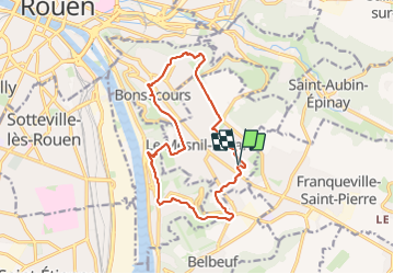

Length
13.7 km

Max alt
209 m

Uphill gradient
267 m
Km-Effort
17.3 km

Min alt
14 m

Downhill gradient
267 m
Boucle
Yes
Creation date :
2019-07-02 17:01:45.346
Updated on :
2019-07-02 17:01:45.346
--
Difficulty : Unknown

FREE GPS app for hiking
 SityTrail
IGN / Geographical institutes
SityTrail Plus
The world is yours!
About
Trail Walking of 13.7 km to be discovered at Normandy, Seine-Maritime, Le Mesnil-Esnard. This trail is proposed by doudet.
Positioning
Country:
France
Region :
Normandy
Department/Province :
Seine-Maritime
Municipality :
Le Mesnil-Esnard
Location:
Unknown
Start:(Dec)
Start:(UTM)
365882 ; 5474421 (31U) N.
Comments